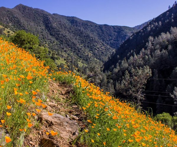
Take a half mile rock scramble up to the summit of the 11,570-foot Leavitt Peak located off the stretch of the Pacific Crest Trail heading south from Sonora Pass that is famous for its 100-mile Sierra views of glistening alpine lakes, soaring peaks and wind-swept treeless ridges coated with a blanket of wild flowers in late spring and early summer.
It is on the western slopes of Leavitt Peak where the foremost reach of the Stanislaus River watershed starts. Snow melt from the lofty summit eventually reaches the headwaters of the 45.7 mile Middle Fork of the Stanislaus River. The Middle Fork flows into a steep canyon where Donnells Reservoir sits with 58,961 acre feet of water storage at the 4,903-foot elevation. Water then flows into Beardsley Reservoir with 87,521 acre feet of water storage at the 3,382-foot elevation.
Two reservoirs — part of the Tri-Dam Project built 65 years ago by South San Joaquin Irrigation District and Oakdale Irrigation District — captures water that is the lifeblood of the South County. The water eventually will irrigate 52,000 acres of farmland around Manteca, Ripon, and Escalon and provide drinking water to the cities of Manteca, Tracy, and Lathrop plus in a few years Ripon as well.
Beardsley releases water back into the Stanislaus to eventually flow into New Melones Reservoir.
The Stanislaus drains a 1,075-square-mile basin that historically generates 1.05 million acre feet of water in an average year. The vast majority of that is from snow melt. That average, however, has dropped to 996,000 acre feet since 1985. The inflow was below 300,000 acre feet in 2015.
SSJID and OID secured pre-1914 superior water rights more than a century ago that gives them claim to the first 600,000 acre feet of runoff each weather season.
Those rights were also verified in a contract with the Bureau of Reclamation when the two districts agreed to allow the federal government to inundate the original Melones Reservoir OID and SSJID built in 1925 with New Melones Reservoir. The new reservoir — completed in 1980 — has a capacity of 2.4 million acre feet and more than 100 miles of shoreline.
The Water Problems Start
At New Melones Reservoir
New Melones is where the water fights really start.
The average inflow from the Stanislaus in an average year prior to 1985 was 1.05 million acre feet and has dropped to 966,000 acre feet on an annual average since 1985.
The Bureau — on paper — divvies up the water as follows:
*600,000 acre feet for SSJID and OID split evenly between the two districts.
*247,000 acre feet for fish in the Stanislaus River.
*148,000 acre feet for water quality.
*66,000 acre feet in loss to water evaporation.
*45,000 acre feet to the Stockton East Water District.
Essentially that means long-term storage only happens in wet years.
Making the water situation worse in terms of over commitment are Bureau decisions working in concert with state water officials that have led to the release of an additional 500,000 plus acre feet of water since 2011 for fish. That decision was made based on a 2009 National Marine Fisheries Service biological opinion that the SSJID and OID contend — and federal courts concur — is not based on any scientific proof that more water releases help increase fish population.
When water is released from New Melones it makes its way to Lake Tulloch — the third component of the Tri-Dam Project built in the 1950s. The reservoir holds roughly 63,000 acre feet. Built as an agricultural water storage facility and hydroelectric producer, land developers capitalized on the fact OID and SSJID did not secure nearby land. As a result, homes well in excess of $1 million have sprung up along its shores near the community of Copperopolis given it is one of the few lakes in California with privately owned shorelines.
Goodwin Dam: First
Reservoir Built On River,
Last Dam Before Water
Reaches The San Joaquin
From Tulloch Lake water returns to the Stanislaus and is released almost immediately into Goodwin Dam located just above Knights Ferry. Goodwin, completed in 1913, is essentially a diversion dam. It sends water to both districts including SSJID’s 300 plus miles of ditches, tunnels and flumes to ultimately serve agricultural and urban users. SSJID’s diverted water flows first into Woodward Reservoir. Completed in 1916, it gives SSJID 36,000 acre feet of off river storage — something that OID does not have.
If it hadn’t been for the Bureau’s decision to build New Melones, the five on-river reservoirs created by dams would have been controlled exclusively by OID and SSJID. The projects were all built without a penny in state or federal money.
After Goodwin, the Stanislaus flows into Goodwin Canyon featuring a series of Class II and IV rapids for rafters — including the famous Mr. Toads’ Wild Ride that pushes the Class V envelope.
From there it flows under the longest covered wooden bridge west of the Mississippi River at Knights Ferry and makes a lazy run through Riverbank, Oakdale, past Ripon and then Caswell Memorial State Park before the Stanislaus River ends its 95.9-mile run at its confluence with the San Joaquin River southwest of Manteca just a few hundred feet south of the Airport Way bridge.