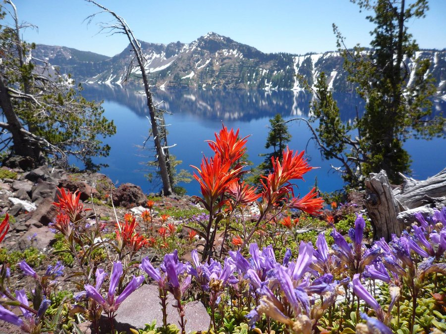


KLAMATH FALLS, OREGON — Crater Lake has the clearest and deepest blue water in the United States.
Its clarity surpasses Lake Tahoe given the only water that flows into the lake is snowmelt from the caldera walls that soar from 500 to as high as 2,000 feet above the surface.
And unlike Lake Tahoe, which naturally is fed only by snowmelt, there hasn’t been tainting by any humans living in its watershed.
It’s why the National Park Service operates it as a preserved lake and not a recreational lake.
Crater Lake is deep. Real deep.
It is 1,949 feet to the bottom, making it the deepest lake in the United States and ninth deepest in the world.
Lake Tahoe is No. 2 in the USA with a depth of 1,645 feet.
If you haven’t guessed, Crater Lake was created as the result of a volcano’s caldera collapsing.
The United States Geological Services does not list it as an active volcano, per se.
That doesn’t mean it can’t erupt in the future.
The last actual eruption was a small one at Crater Lake about 5,000 or so years ago that created a small lava dome that is now underwater to the east of Wizard Island.
The main event that created Crater Lake — a massive eruption that collapsed the Mount Mazama volcano into itself — is pinned by scientists as being roughly 7,700 years ago.
Since then, roughly 100 feet deep of sediment has accumulated at the bottom of the 1,949-foot-deep lake.
To put that in perspective, the face of El Capitan soars just over 3,000 feet above the Yosemite Valley floor.
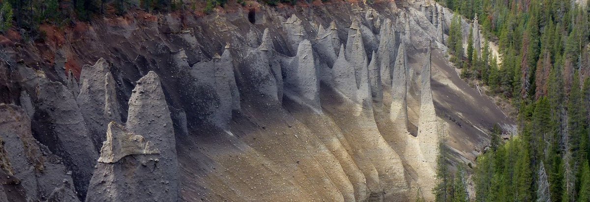
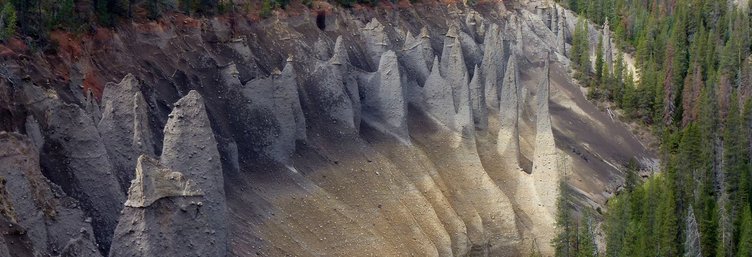
Crater Lake is among the numerous smaller volcanoes and volcanic features outside of the 13 major that form the Cascade Volcanic Arc that is on the Pacific Rim of Fire.
The Cascade Volcanic Arc stretches from southern British Columbia and to Northern California bookended with active volcanoes — Mt. Baker in Washington State and Lassen Peak in California.
Yes, you can swim in
Crater Lake, but ...
Enough of the geology.
What about Crater National Park itself that was formed in 1902 and is the fifth oldest national park?
The park itself encompasses 250 square miles.
It’s a little over a seven-hour drive from Manteca almost all the way on Interstate 5 to Klamath Falls where you get off the Canada-to-Mexico freeway that passes through the Northern San Joaquin Valley. The last 44 miles of the drive are via US Highway 97 and Oregon State Route 62.
A vehicle pass good for up to seven days is $30.
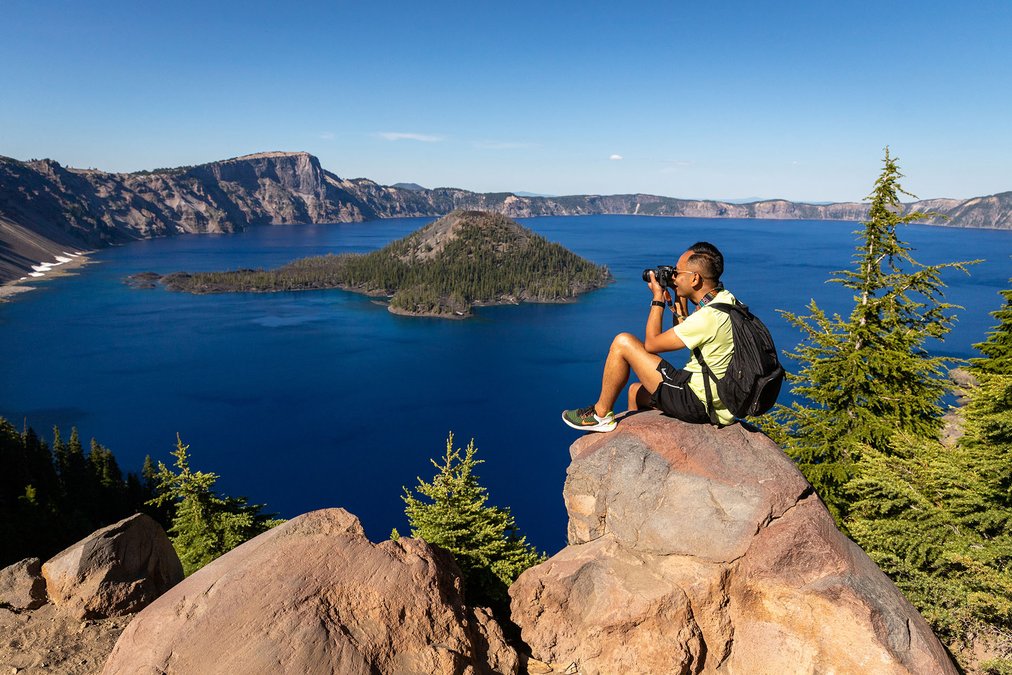
The crown jewel of the park without a doubt is the 20 square-mile lake that is six miles across at its widest point. There is 20 miles of shoreline.
A 33-mile road loops around the rim complete with 30 overlooks.
It’s popular with bicyclists.
Most people travel it by vehicle.
There is a trolley that is a guided tour that includes six stops at overlooks.
Between driving and stops for brief exploration, rangers indicate most people in vehicles complete the loop in two hours or so.
Photography and hiking clearly top the list of things to do at the lake.
That said, don’t miss a chance for stargazing.
The overall park itself has little light pollution. That said, inside the caldera walls even less manmade light spoils the incredible view of the heavens.
The scenery away from Crater Lake inside the park boundaries is nice but it can’t match the spectacular views of the lake.
There are 100 miles of trails in the park with the longest being a 33-mile segment of the Pacific Crest Trail.
The trails in the park that are around the lake per se involve a lot of elevation gain. After all, it’s the remains of a volcano.
The hike with the best view is the Mount Scott trail.
It typically takes an average person 2.5 hours to cover the 4.4 mile out and back trail with a 1,250-foot elevation gain.
The reward at the top is arguably the best overall view of the lake.
There is only one area where you can legally swim in Crater Lake where the surface temperatures never get above 57 degrees in the summer.
It’s at Cleetwood Cove that requires a hike dropping down some 700 feet over 1.1 miles.
It is also where you can catch a ride on the only boat allowed in the lake.
The boat obviously requires a ticket. Options include a cruise around the lake or a quick trip to Wizard Island in the middle of the lake.
The tours are guided.
Neither swimming or boat rides will be possible after the end of this summer until the summer of 2029. It’s due to needed repair work at the marina and a need to shore up some of the shoreline.
As for campgrounds, there are two locations to camp away from the lake.
There is also lodging and dining at Rim Village.
The park’s history
The National Park Service notes history indicates that the Klamath Indians knew of, but seldom visited, Crater Lake before its discovery by white men.
The Indians regarded the lake and the mountain as the battleground of the gods.
Crater Lake was “discovered” on June 12, 1853, by John Wesley Hillman, a young prospector leading a party in search of the “Lost Cabin Mine.”
Having failed in their efforts, Hillman and his party returned to Jacksonville, a mining camp in the Rogue River Valley, and reported their discovery which they had named Deep Blue Lake.
This incident was apparently forgotten in the excitement of gold discoveries and Indian wars.
On October 21, 1862, Chauncey Nye, leading a party of prospectors from eastern Oregon to Jacksonville, happened upon the lake. Thinking that they had made a discovery, they named it Blue Lake.
A third “discovery” was made on August 1, 1865, by two soldiers stationed at Fort Klamath, who called it Lake Majesty. In 1869 this name was changed to Crater Lake by visitors from Jacksonville.
Before 1885, Crater Lake had few visitors and was not widely known.
On August 15 of that year William Gladstone Steel, after 15 years of effort to get to the lake, stood for the first time on its rim.
Inspired by its beauty, Judge Steel conceived the idea of preserving it as a national park.
For 17 years, with much personal sacrifice, he devoted time and energy to this end. Success was realized when the park was established on May 22, 1902. Steel devoted the remainder of his life to development of the park, serving as its second superintendent and later as park commissioner, an office he held until his death in 1934.